
Pix4D SA software
Data Capture Applications
Optimal 2D Mapping and 3D Modeling
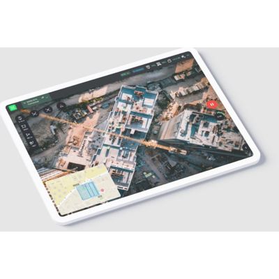
Unlock the power of your drone with PIX4Dcapture Pro for optimal 2D mapping and 3D modeling. Precision flight made easy: the ultimate RTK drone companion app. Terrain awareness: Push the limits of aerial mapping by getting accurate maps when flying over uneven terrain. This function helps pilots prevent gaps in dataset collection by adapting to the terrain being surveyed. Network RTK: Get reliable and accurate maps and models thanks to careful flight planning. PIX4Dcapture Pro enables Network RTK support to achieve centimeter level drone positioning and accuracy for results that are true-to-reality. Offline maps: Plan your missions in advance so you can work offline using a downloaded street or satellite basemap. Get a visual reference before you go out into the field to streamline your workflows.